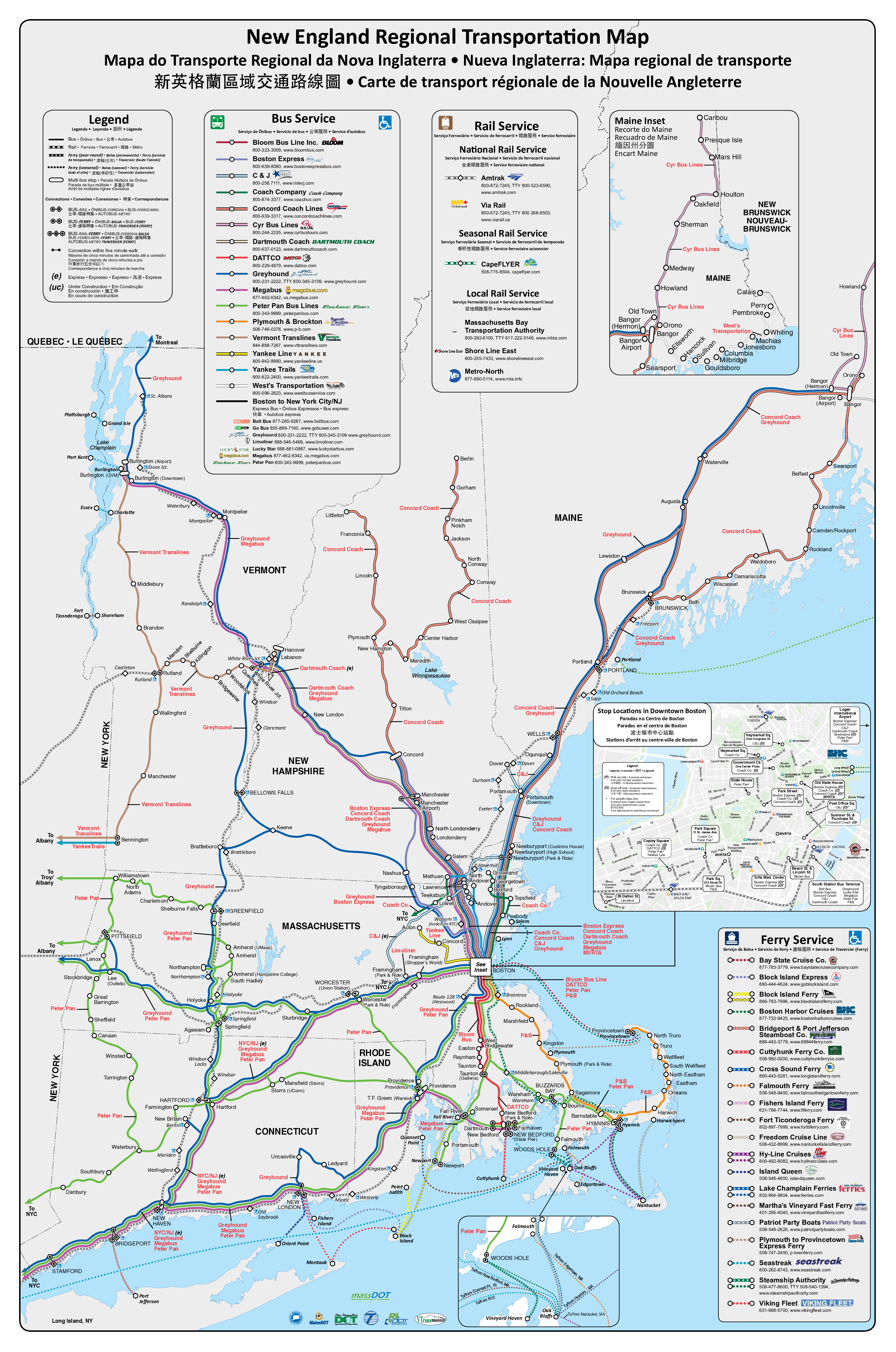
For even more information, you can look to the MBTA's maps which include a full system map. Honestly, we really need an app to find routes for us; Google maps and similar suck at public transit and even the one endorsed by the MBTA (called Transit funnily enough) doesn't do a great job for the region.
Also, yes I love taking the buses from New Hampshire and leaving my car behind!
8 Comments
NewEnglandBlueberry@lemmy.world · 3 pts · 3y
Here's the source for those who want a higher resolution.
bloodsangre7@lemmy.world · 2 pts · 3y
Really well done, I had no idea there were that many services available. Even if they are just buses its very useful for those living car-free
NewEnglandBlueberry@lemmy.world · 2 pts · 3y
For even more information, you can look to the MBTA's maps which include a full system map. Honestly, we really need an app to find routes for us; Google maps and similar suck at public transit and even the one endorsed by the MBTA (called Transit funnily enough) doesn't do a great job for the region.
Also, yes I love taking the buses from New Hampshire and leaving my car behind!
Spacebar@lemmy.world · 3 pts · 3y
All road traffic gets stuck just outside of Boston.
NewEnglandBlueberry@lemmy.world · 1 pts · 3y
I absolutely hate driving in Boston. So when I go down there I prefer to take either the T in (usually the red or green lines) or take a bus.
Spacebar@lemmy.world · 2 pts · 3y
It's really only bad during the week. Weekends are fine. I do prefer the train though.
drdabbles@lemmy.world · 2 pts · 3y
Cape Cod did a rail study to extent the commuter service down to Bourne at least and potentially into Hyannis. https://www.capecodcommission.org/our-work/cape-rail-study/
The report expects they could reduce car traffic by at least 800 vehicles per day, potentially more.
NewEnglandBlueberry@lemmy.world · 2 pts · 3y
That would be pretty sweet.