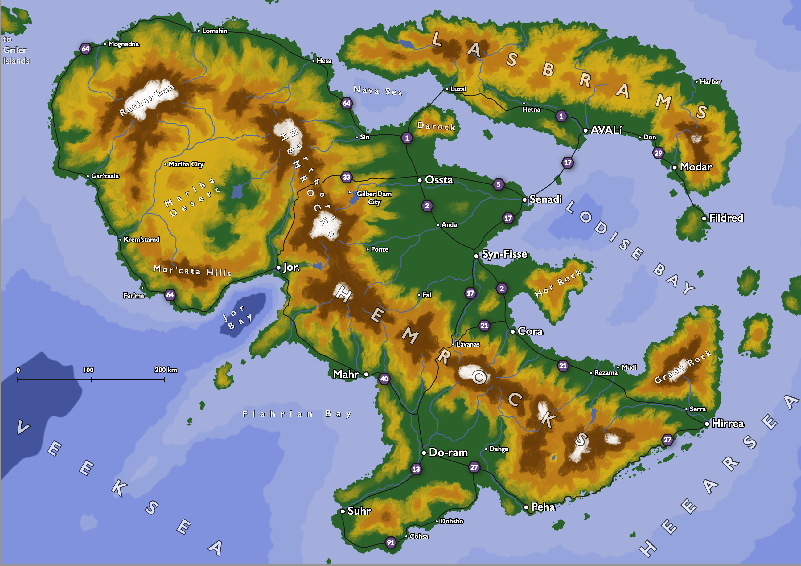
Hi! This is the map for the island country of Ava-Lodise. It is a modern country, with similar levels of technology to our world. The largest cities are Avalí (the capital), Suhr, Senadi and Hirrea. There are several different ethnic groups in the country, from Avalonian (from Ava, the smaller island where Avalí is), East Lodisean (the east coast of the large island), Flahrian (south west of Lodise), Veeker (west of the desert) and Senmi (north of the desert).
I made it for a project that I am really proud of how it looks, but I can't share it here because for that one I used a lot of AI generated images: A Travel Guide to Ava-Lodise.
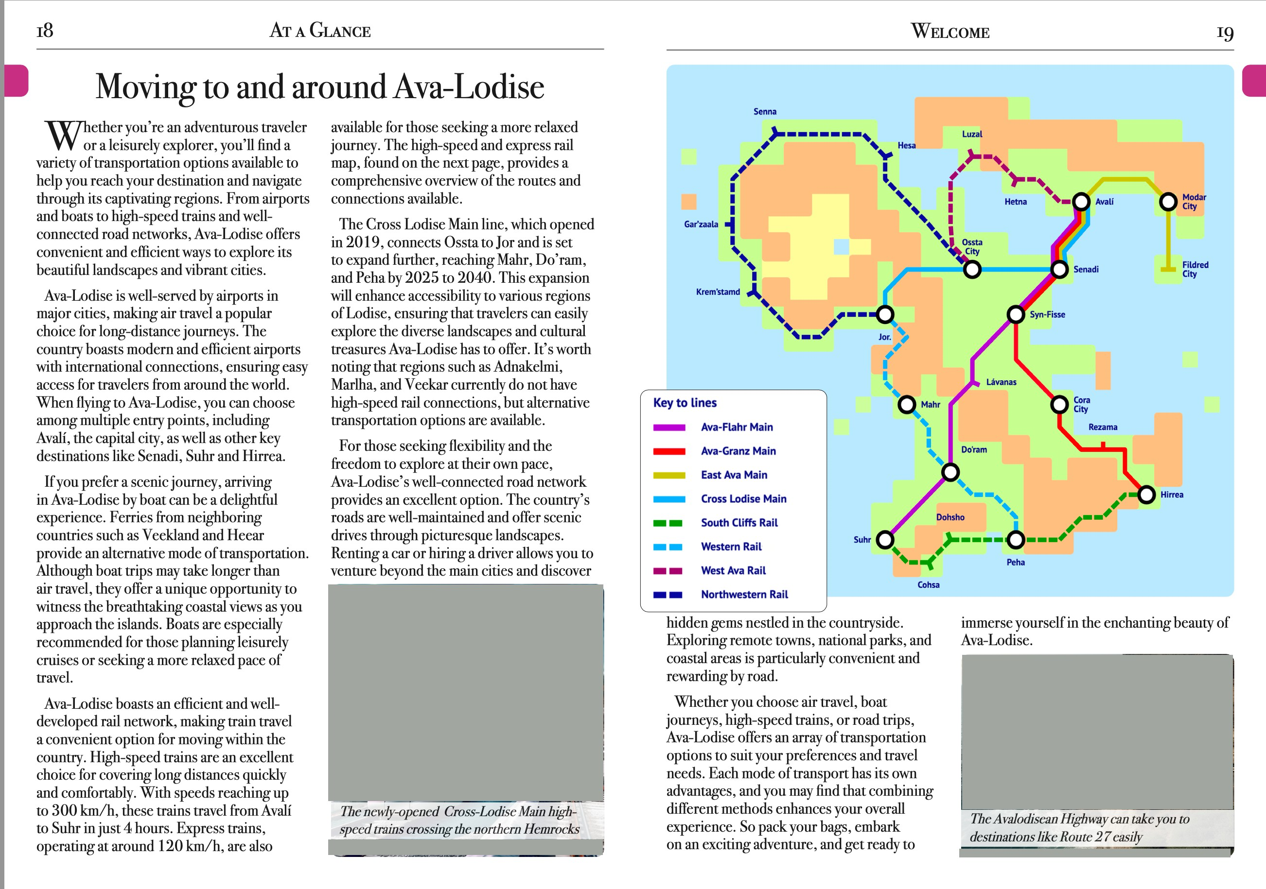
here is one example page of that project (i removed the AI-generated images):
5 Comments
Gradually_Adjusting@lemmy.world · 2 pts · 3y
Well done! Did you use Illustrator for this?
kinsnik@lemmy.world · 3 pts · 3y
thanks!
the map i did it with Procreate, but the rest is done in InDesign. The train map is from a website to create subway maps that i don't remember right now
Gradually_Adjusting@lemmy.world · 2 pts · 3y
That's rad. It really looks like an in-universe pamphlet.
NormBleac@lemmy.world · 1 pts · 3y
Clearly a lot of work: it looks awesome. By the way; why did you remove the AI-generated images?
kinsnik@lemmy.world · 1 pts · 3y
Thanks! I removed the ai generated pictures because they go against the rules of here