Prussian Kingdom was technically one state in the German Empire. But since the Prussian king was the emperor, distinction between them was somewhat artificial.
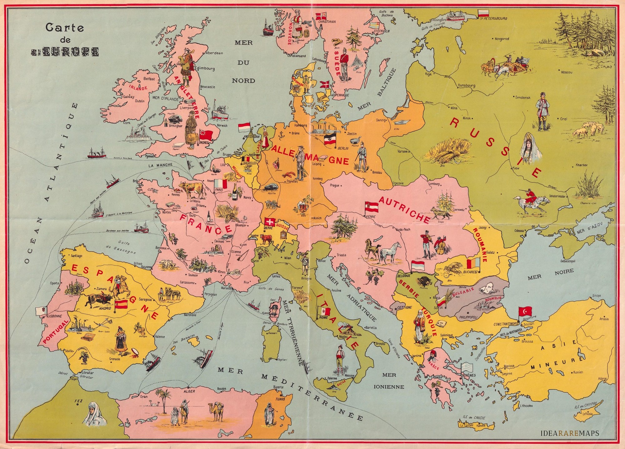
It's should be from 1878-1885, as it shows Eastern Rumelia as a somewhat separate state. It was an autonomous province of Bulgaria for that 8 years; https://en.wikipedia.org/wiki/Eastern_Rumelia
I couldn't find anything to narrow it even more.
But it has some errors, e.g. Austria wa called Austria-Hungary at that time
I was bummed that they gave Bulgaria a fifth color, when they were clearly aware that you only need four colors, but then I saw that it's not a contiguous landmass, so I guess, that's a valid way of grouping those two...
9 Comments
morto@piefed.social · 20 pts · 110d
Those older maps with overlay drawings were so cool
whyNotSquirrel@sh.itjust.works · 10 pts · 110d
I never understood if it was Prussia or already Germany before WW1
PenguinInLaw@sh.itjust.works · 14 pts · 110d
Prussian Kingdom was technically one state in the German Empire. But since the Prussian king was the emperor, distinction between them was somewhat artificial.
Sergio@piefed.social · 9 pts · 109d
I love how Corsica has a picture of Napoleon.
PenguinInLaw@sh.itjust.works · 9 pts · 110d
Pre-Balkan wars even.
infeeeee@lemmy.zip · 8 pts · 109d
It's should be from 1878-1885, as it shows Eastern Rumelia as a somewhat separate state. It was an autonomous province of Bulgaria for that 8 years; https://en.wikipedia.org/wiki/Eastern_Rumelia
I couldn't find anything to narrow it even more.
But it has some errors, e.g. Austria wa called Austria-Hungary at that time
PugJesus@piefed.social · 2 pts · 109d
Colloquially 'Austria' (or equivalents) was still widely used, just as the Ottoman Empire is referred to Turkiye here.
Ephera@lemmy.ml · 6 pts · 109d
I was bummed that they gave Bulgaria a fifth color, when they were clearly aware that you only need four colors, but then I saw that it's not a contiguous landmass, so I guess, that's a valid way of grouping those two...
Vinylraupe@lemmy.zip · 2 pts · 109d
Switzerland be like: